Amazon Dry Season: Authorities Warn of Critic...
read more
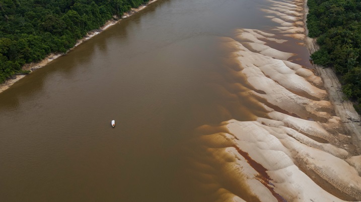
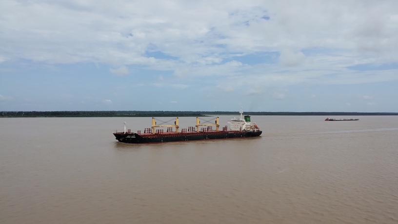
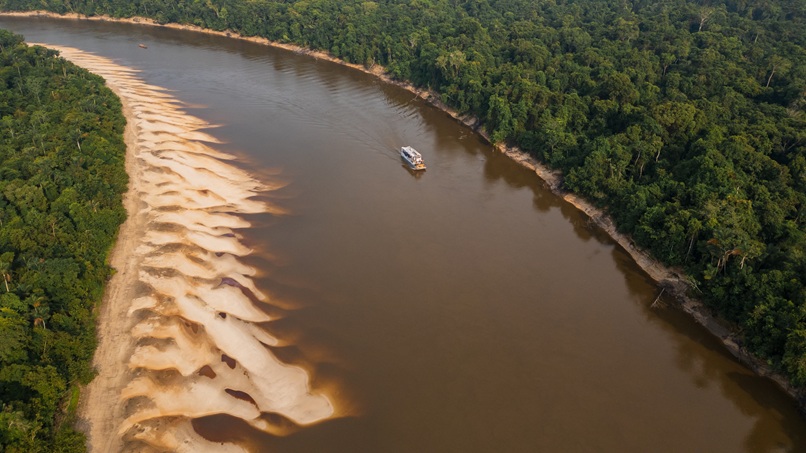
As the Amazon River and its tributaries continue to endure record-low water levels, ports in the region struggle to sustain waterborne trade while ships experience prolonged delays
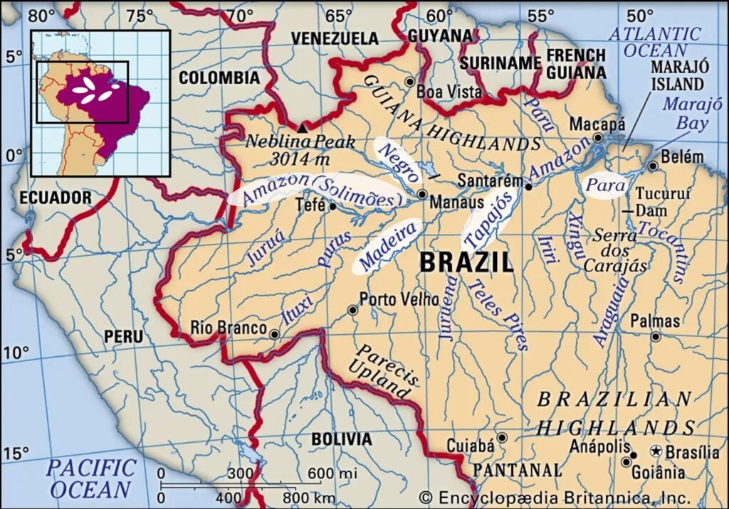
The Madeira River, a major tributary of the Amazon, plays a crucial role in outflowing agricultural products, chiefly soya beans and maize (corn), from the food powerhouse state of Mato Grosso, as well as containers, trailers and semi-trailers packed with general cargo. These goods are hauled up the Northern Corridor via highway BR-364 to Rondonia state’s capital, Porto Velho, on the Madeira River. In Porto Velho, the agriproducts are transferred to barges sailing downriver to the port of Itacoatiara on the left margin of the Amazon River near the mouth of the Madeira. The containers, trailers, and vehicles barged down the Madeira are unloaded in Manaus to supply the western Amazon market and also for transhipment to cabotage and long-haul ships. Upon their return to Porto Velho, the barges backhaul imported fertilisers, fuels, industrial inputs, and consumer goods manufactured in the Manaus Free Trade Zone for distribution in central Brazil.
Highway BR-319 is the only land link between Porto Velho and Manaus, the largest city in the North region and the capital of Amazonas state. However, as this federal highway remains unpaved for most of its length across the Amazon rainforest and is virtually impassable for heavy vehicles such as bulk lorries, the ‘Madeira Axis’ of the North Corridor becomes a vital link between the western Amazon and the rest of the country. Therefore, the drying up of this important waterway not only hinders the flow of grains across the so-called Northern Arc ports but also profoundly affects the supply of food, water and essential products to the deprived riverside communities of the Amazon that rely heavily on river transport for their mobility and livelihoods.
According to statistics from the local River Captaincy of the Western Amazon (CFAOC), the maximum and minimum levels of the navigable stretch of the Madeira River 90% of the time are 6.8 m (December to March) and 1.7 m (April to November), respectively. This year, the dry season along this waterway began much earlier than last year’s record lows and is expected to last much longer than ever before. Water levels near Porto Velho have fallen to less than 34 centimetres earlier this week, hindering commercial river navigation. The Jirau and Santo Antonio hydroelectric plants upstream from Porto Velho are also facing critically low river levels and flows. They are operating at minimum capacity, putting further strain on the national energy grid, which is already stressed by the consequences of the drought elsewhere in the country.
Manaus is the main gateway to the western Amazon and home to the only container port terminal facilities in the region. It sits upstream from the ‘meeting of the waters’, where the black-water Negro River on the left merges with the sandy-coloured, white-water Solimões River on the right to continue flowing to the Atlantic as the Amazon River, the world’s largest river by volume. Due to water levels dropping to alarming lows in the Negro and Solimões, cargo ships and large barges are unable to approach Manaus’ shores.
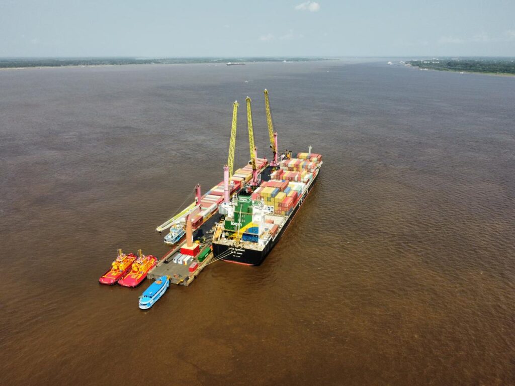
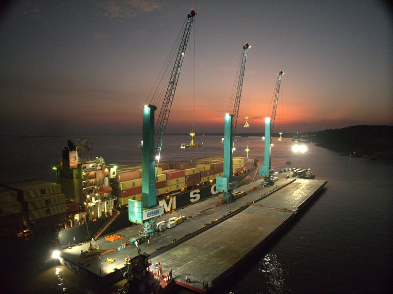
Due to the severe drought plaguing the Amazonas’ capital this year, local port operators have temporarily relocated their container operations further downstream of the Amazon River to Itacoatiara, part of the metropolitan region of Manaus. Port operators have received permission from customs and maritime authorities to set up makeshift floating piers with cranes off the left bank of the Amazon. Containers are being loaded, transshipped and unloaded from or onto barges sailing shuttling between Manaus Itacoatiara to feed containerships that are travelling as far as Itacoatiara. In a recent accident, a number of containers fell off a barge into the river; however, all the boxes were successfully retrieved with no reports of personal injuries or environmental pollution. The maritime authority is conducting an inquiry into the incident.
Today, the CFAOC recommended vessels transiting the mouth of the Madeira or along the Tabocal Passage should observe a maximum sailing draft of 5.67 m and a minimum under-keel clearance (UKC) of 1.18 m for containerships. For ships carrying dangerous goods, the recommended maximum draft is 5.31 m, and the minimum UKC is 1.54 m. However, the situation is fluid and changes daily.
The drought has severely disrupted cargo barging from Porto Velho to the grain port of Itacoatiara and, even more so, the recently opened Novo Remanso port facility further up the Amazon. As a result, there is a cargo shortage at these port facilities, leading to much longer waiting times for berthing and loading, as well as reduced volumes shipped, possibly leading to dead freight claims.
In the remote town of Juruti, a port facility on the right bank of the Amazon River exclusively handles locally mined bauxite. The ore is then shipped in bulk carriers to aluminium smelters in São Luis, on the Northeast coast. Despite the ongoing severe drought, this private riverport remains operational. However, bauxite carriers have been facing draft limitations imposed due to falling river levels. The departure draft limitation in Juruti is determined only after the ship comes alongside, based on the latest bathymetric readings available and the lowest water levels encountered by the vessel during her passage upriver to the berth. Currently, ships that normally leave Juruti with drafts of up to 11.50 m, which is the limitation prevailing in the North Bar of the Amazon for self-piloted passages, are sailing out with drafts of about 10.75 m or less. Similar to other Amazon ports, the situation in Juruti is constantly changing.
The Trombetas River is another tributary of the Amazon that is navigable in its lower part. Located on the right bank of the river, this port facility handles solely bauxite, transported on bulkers in short river passages down to an alumina refinery in the port of Vila do Conde (Barcarena) as well as abroad. Albeit this private port remains operational amid the drought, falling water levels are also causing draft limitations. Today, the sailing draft restriction from Trombetas was 8 m, but it can be reduced even further in the next few days should the dry season persist.
A large volume of soya beans and corn harvested in Mato Grosso and Pará are trucked on the highway BR-163, the ‘Soya Highway’, as far as barge stations in Miritituba (Itaituba) on the right bank of the Tapajós River. From there, the agriproducts are barged some 140 nm downstream to the port of Santarém, where the Tapajós empties into the Amazon River.
In line with other Amazon waterways, the ‘Tapajós Axis’ of the North Corridor is also enduring its worst drought ever, with the river levels plummeting to unprecedented low depths. This has led to the halting of barge transportation from Miritituba stations, forcing traders to haul the grains along the entire length of the BR-163 until its very end at the port of Santarém.
Apart from supplying the port terminals of Santarém, the products barged from Miritituba in the Tapajós also feed the grain ports of Santana (Macapá), in the North Bar of the Amazon, as well as the ports of Vila do Conde (Barcarena) and Belém in the Pará River, to the southeast of the Marajó Island. Therefore, although these ports to the far east of the Amazon are not suffering from low water levels, they are affected by the shortage of grains coming out of the Tapajós waterway.
Sailing restrictions are dictated by draft limitations at the North Bar for vessels leaving ports upstream of the Amazon River or draft limitations at the mouth of the Pará River for ships leaving the ports of Vila do Conde (Barcarena) and Belém through the Espadarte or Quiriri Channel.
Owners fixing vessels to operate in the Amazon ports are strongly advised to closely liaise with the local agents, pilot stations and designated port facility to confirm current draft restrictions at the anchorage, berth and throughout the river passage in and out.
Masters and crews of cargo ships and barges navigating the region must remain vigilant about navigation and security hazards in the Amazon. Barge convoys transporting consumer products and fuel cargoes are prone to cargo pilferage, armed robbery and looting, especially during the dry season, when ships move slower along the rivers. To reduce these risks, it is essential to devise a proper passage plan and implement necessary preventive measures as outlined in the ISPS Code and the ship security plan.
Particular attention should be given to:
Three different pilotage zones cover the Amazon ports, and specific rules and tariffs apply concerning the hiring and cancellation of river pilots. When navigation incidents happen with the vessel under pilotage or after the window for cancelling the pilot has passed, extra pilotage charges can substantially increase the outlays involved. Therefore, shipowners and operators visiting the area should familiarise themselves with Amazon’s pilotage rules.
Please read our disclaimer.
Related topics:
Rua Itororó, 3 - 3rd floor
11010-071 - Santos, SP - Brazil
Telephone +55 13 4009 9550
proinde@proinde.com.br
Rua Barão de Cotegipe, 443 - Sala 610 - 96200-290 - Rio Grande/RS - Brazil
Telephone +55 53 3233 1500
proinde.riogrande@proinde.com.br
Av. Rio Branco, 45 - sala 2402
20090-003 - Rio de Janeiro, RJ - Brazil
Telephone +55 21 2253 6145
proinde.rio@proinde.com.br
Rua Professor Elpidio Pimentel, 320 sala 401 - 29065-060 – Vitoria, ES – Brazil
Telephone: +55 27 3337 1178
proinde.vitoria@proinde.com.br
Rua Miguel Calmon, 19 - sala 702 - 40015-010 – Salvador, BA – Brazil
Telephone: +55 71 3242 3384
proinde.salvador@proinde.com.br
Av. Visconde de Jequitinhonha, 209 - sala 402 - 51021-190 - Recife, PE - Brazil
Telephone +55 81 3328 6414
proinde.recife@proinde.com.br
Rua Osvaldo Cruz, 01, Sala 1408
60125-150 – Fortaleza-CE – Brazil
Telephone +55 85 3099 4068
proinde.fortaleza@proinde.com.br
Rua dos Azulões, Sala 111 - Edifício Office Tower - 65075-060 - São Luis, MA - Brazil
Telephone +55 98 99101-2939
proinde.belem@proinde.com.br
Tv. Joaquim Furtado, Quadra 314, Lote 01, Sala 206 - 68447-000 – Barcarena, PA – Brazil
Telephone +55 91 99393 4252
proinde.belem@proinde.com.br
Av. Dr. Theomario Pinto da Costa, 811 - sala 204 - 69050-055 - Manaus, AM - Brazil
Telephone +55 92 3307-0653
proinde.manaus@proinde.com.br