New Ballast Water Requirements at Bahia Ports
read more
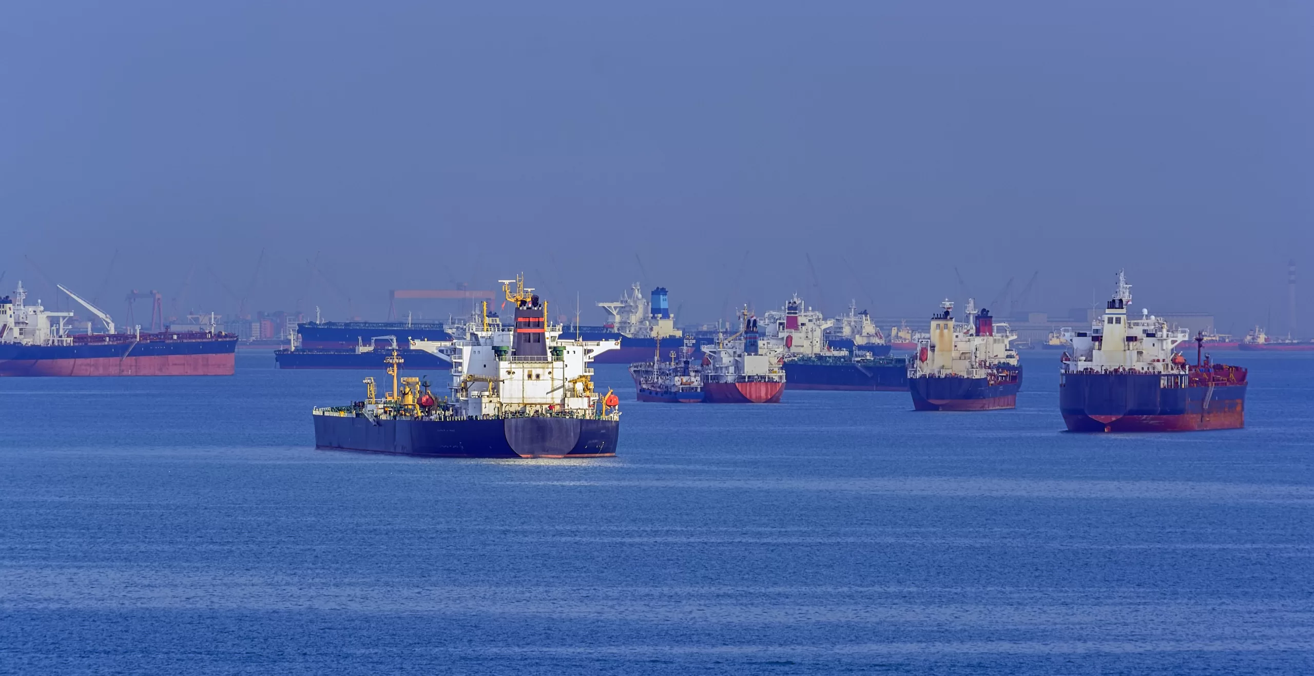
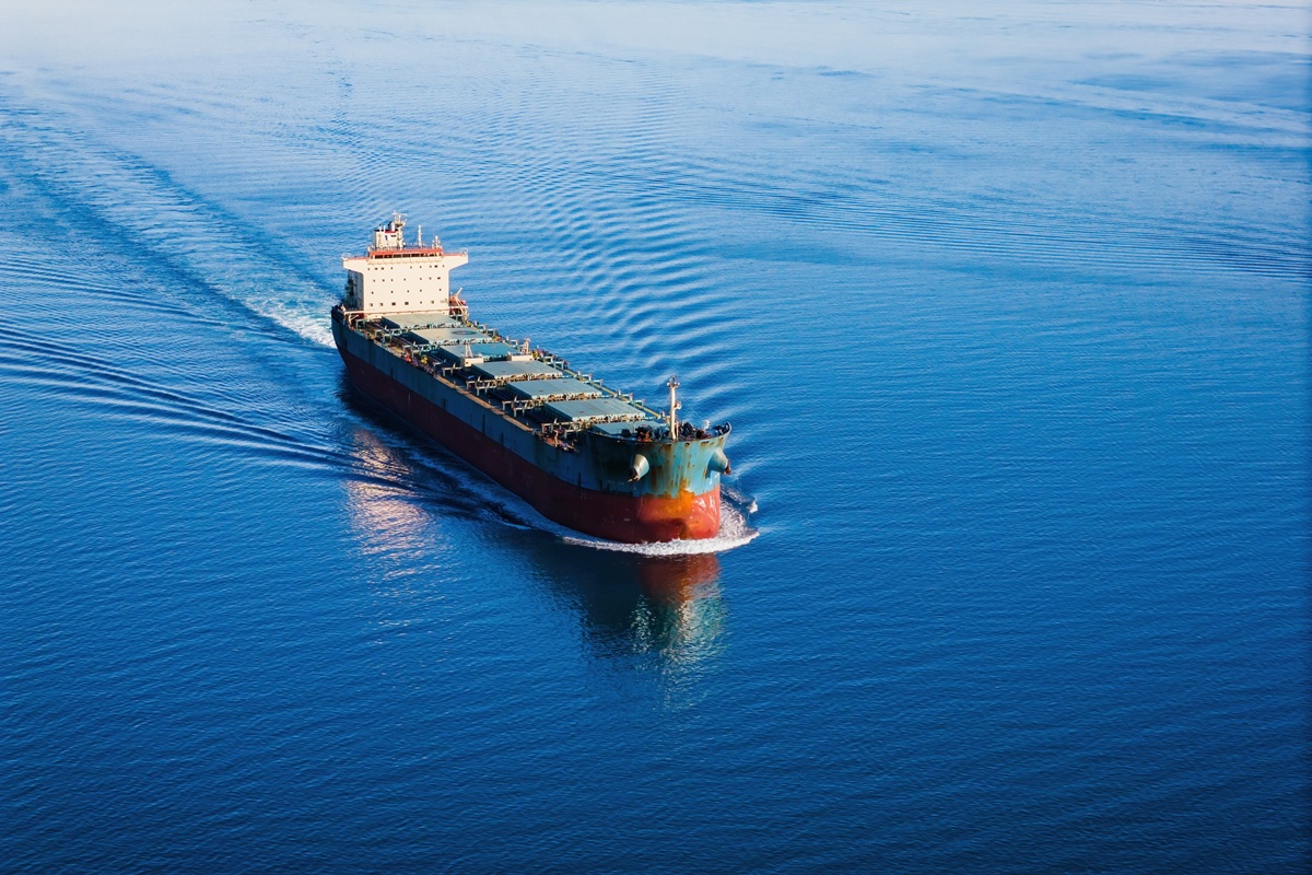
The Port of Captaincy in Santos is cracking down on vessels that drop anchor outside the anchorage areas delimited in the relevant nautical charts
The Rules and Procedures of the Maritime Authority of São Paulo – NPCP-SP (available for download in Portuguese only) impose restrictions on vessels anchoring at Santos and São Sebastião ports.
Since early this year, the Port Captaincy in the Port of Santos has been actively monitoring vessels that anchor outside the anchorage areas indicated in the charts published by the Brazilian Navy’s Directorate of Hydrography and Navigation (DHN). Vessel movement is assessed using an AIS system or through boat surveillance.
Shipmasters caught in breach of the regulation were fined. The penalties were framed under ‘Group G’ of the Maritime Traffic Regulation (LESTA), which establishes fines ranging from BRL 80 to BRL 3,200, without prejudice to other administrative sanctions. However, in the event of recurrence in a period equal to or less than twelve months, the fine will be doubled exponentially according to the repetition of violations of maritime traffic regulations.
a) Anchoring areas
There are 6 (six) anchorage areas, with anchoring outside them prohibited. The anchorage areas are indicated on the DHN chart 1701. The coordinates of the respective anchorage areas are detailed on the Santos Port Authority (SPA) website as follows:
Anchorage #1: Warships only.
Latitude Longitude
23º 59′ 21″ S 46º 20′ 44″ W
23º 59′ 21″ S 46º 20′ 07″ W
23º 59′ 58″ S 46º 20′ 20″ W
23º 59′ 58″ S 46º 20′ 44″ W
Anchorage #2: for ships needing sanitary inspection or clearance (crew debarkation/embarkation, workshops and materials), with a maximum of 3 (three) hours stay.
Latitude Longitude
24º 00′ 42″ S 46º 20′ 06″ W
24º 00′ 42″ S 46º 19′ 37″ W
24º 01′ 29″ S 46º 19′ 37″ W
24º 01′ 27″ S 46º 20′ 26″ W
Anchorage #3: for ships with a defined berthing schedule for the next 24 hours.
Latitude Longitude
24º 03′ 45″ S 46º 21′ 05″ W
24º 03′ 45″ S 46º 19′ 16″ W
24º 05′ 14″ S 46º 17′ 56″ W
24º 06′ 00″ S 46º 17′ 57″ W
24º 05′ 58″ S 46º 22′ 06″ W
Anchorage #4: for ships with or without a berthing schedule.
Latitude Longitude
24º 13.75’ S 46º 13.90’ W
24º 13.75’ S 46º 20.38’ W
24º 10.53’ S 46º 22.70’ W
24º 08.27’ S 46º 22.70’ W
24º 08.28’ S 46º 17.88’ W
24º 05.28’ S 46º 17.87’ W
24º 05.28’ S 46º 10.00’ W
24º 10.33’ S 46º 09.97’ W
Anchorage #5: for ships carrying flammable or explosive cargoes.
Latitude Longitude
24º 13.75’ S 46º 13.90’ W
24º 13.75’ S 46º 20.38’ W
24º 15.00’ S 46º 19.38’ W
24º 15.00’ S 46º 15.35’ W
Anchorage #6: for quarantining ships and vessels with suspected damage to the packaging and/or leakage of radioactive material.
Latitude Longitude
24º 05′ 00″ S 46º 24′ 27″ W
24º 05′ 00″ S 46º 22′ 45″ W
24º 07′ 12″ S 46º 23′ 42″ W
24º 07′ 12″ S 46º 25′ 27″ W
b) Restrictions
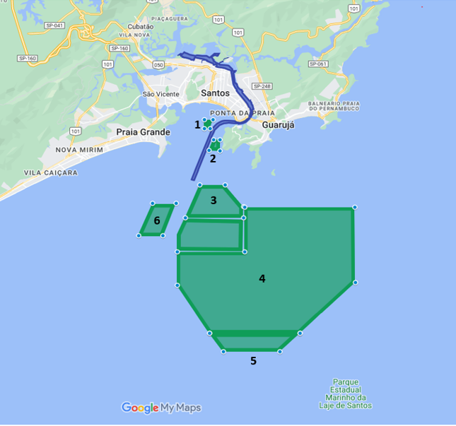
An interactive map of the Santos anchorage areas is available at this link. (Requires Google Maps).
a) Anchoring areas
It has 2 (two) anchorage areas, namely:
i. North Bar: limited to the north by the alignment with“Farolete São Sebastião” and “Ponta das Canas” and to the south by the alignment “Pontal da Cruz e Trapiche da Vila de Ilhabela”. The anchorage areas are those provided for on the DHN char 1614, and the rule applies to ships with deadweight over 100,000 m/t, or that need emergency repairs, a refuge from bad weather, or that are awaiting orders.
ii. South Bar: limited to the north by the alignment with “Ponta do Baleeiro” with the central part of “Praia das Fazendas” and to the south by the parallel 23° 54.0’ S and the meridian 045° 31.0’ W, with capacity for four ships at a time, at the following anchorage points:
Latitude Latitude
(1) 23° 50.2’ S 045° 25.6’ W
(2) 23° 50.6’ S 045° 26.1’ W
(3) 23° 51.0’ S 045° 26.6’ W
(4 ) 23° 51.5’ S 045° 27.1’ W
The maritime authority recommends anchoring with seven shackles, given the intensity of the existing tidal current in the area.
b) Restrictions
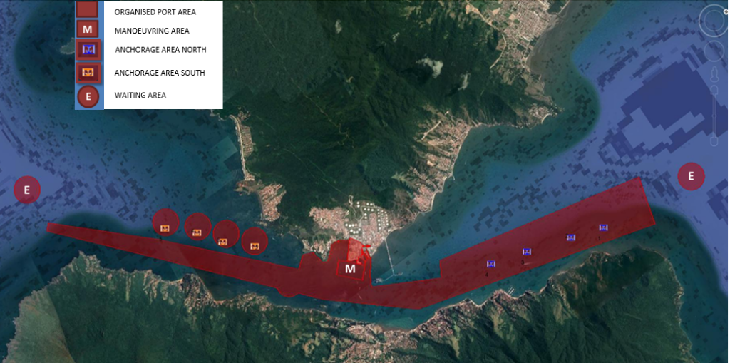
An interactive map of the Anchorage areas of the Port of São Sebastião is available at this link. (Requires Google Earth).
The infractor is entitled to present an administrative defence within 15 (fifteen) working days, counting from the receipt of the notice of infraction drawn by the agent of the maritime authority, under penalty of being condemned by default. The authority has 30 (thirty) days to issue a well-grounded decision with a right of an administrative appeal within 5 (five) days from said decision.
Visiting shipmasters should familiarise themselves with local anchoring restrictions and consult the competent authority (through the local agents) and the pilot station in case of doubt about the prevailing anchorage rules.
Please read our disclaimer.
Related topics:
Rua Itororó, 3 - 3rd floor
11010-071 - Santos, SP - Brazil
Telephone +55 13 4009 9550
proinde@proinde.com.br
Rua Barão de Cotegipe, 443 - Sala 610 - 96200-290 - Rio Grande/RS - Brazil
Telephone +55 53 3233 1500
proinde.riogrande@proinde.com.br
Av. Rio Branco, 45 - sala 2402
20090-003 - Rio de Janeiro, RJ - Brazil
Telephone +55 21 2253 6145
proinde.rio@proinde.com.br
Rua Professor Elpidio Pimentel, 320 sala 401 - 29065-060 – Vitoria, ES – Brazil
Telephone: +55 27 3337 1178
proinde.vitoria@proinde.com.br
Rua Miguel Calmon, 19 - sala 702 - 40015-010 – Salvador, BA – Brazil
Telephone: +55 71 3242 3384
proinde.salvador@proinde.com.br
Av. Visconde de Jequitinhonha, 209 - sala 402 - 51021-190 - Recife, PE - Brazil
Telephone +55 81 3328 6414
proinde.recife@proinde.com.br
Rua Osvaldo Cruz, 01, Sala 1408
60125-150 – Fortaleza-CE – Brazil
Telephone +55 85 3099 4068
proinde.fortaleza@proinde.com.br
Rua dos Azulões, Sala 111 - Edifício Office Tower - 65075-060 - São Luis, MA - Brazil
Telephone +55 98 99101-2939
proinde.belem@proinde.com.br
Tv. Joaquim Furtado, Quadra 314, Lote 01, Sala 206 - 68447-000 – Barcarena, PA – Brazil
Telephone +55 91 99393 4252
proinde.belem@proinde.com.br
Av. Dr. Theomario Pinto da Costa, 811 - sala 204 - 69050-055 - Manaus, AM - Brazil
Telephone +55 92 3307-0653
proinde.manaus@proinde.com.br